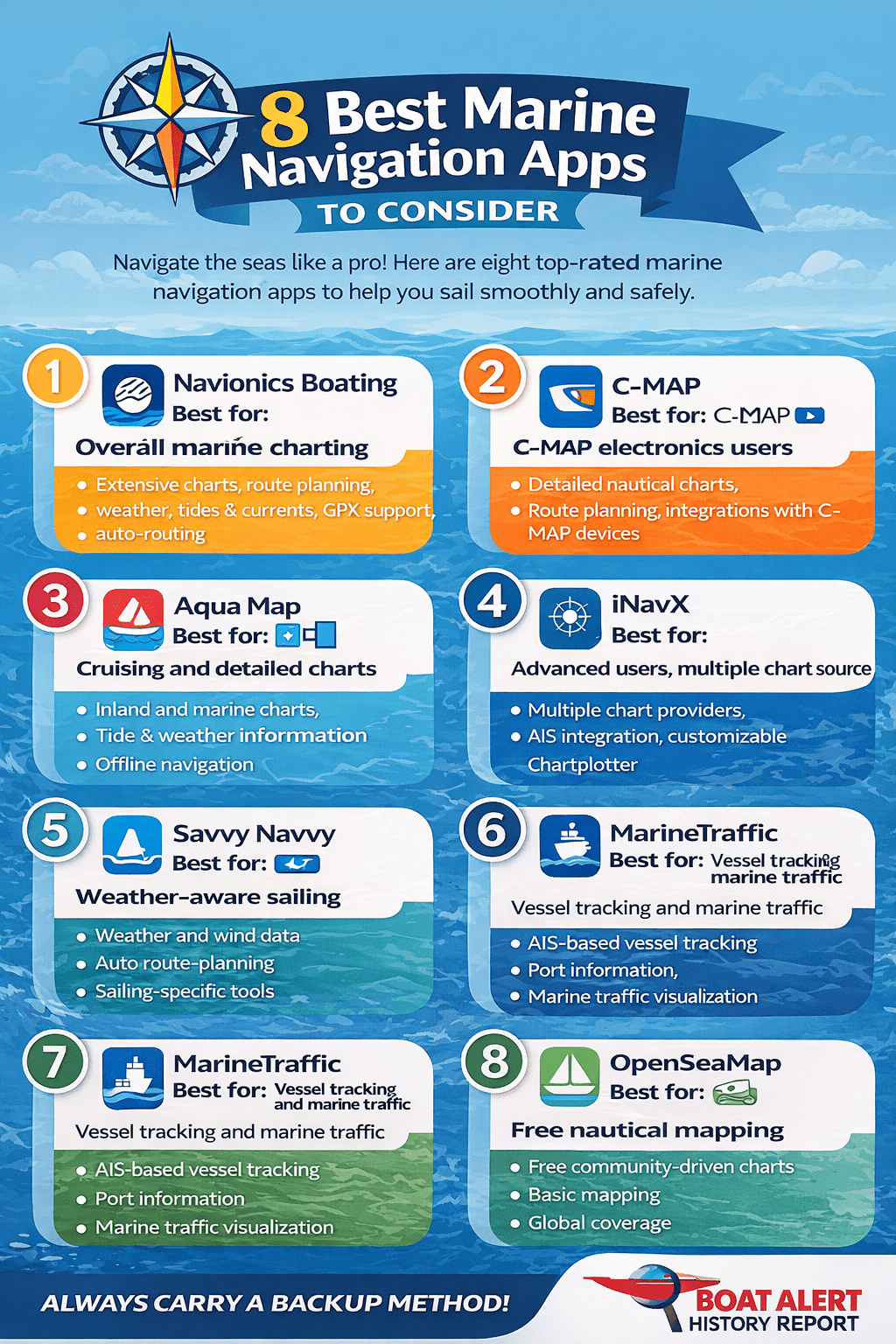
8 Best Marine Navigation Apps to Consider
1. Navionics Boating
Best for: Overall marine charting and navigation
Navionics Boating remains one of the best-known marine navigation applications and is particularly attractive to boaters who want a comprehensive charting package.
The app provides detailed marine and inland-waterway charts, route planning, waypoints, track recording, weather information, tides and currents. Depending on the region and subscription, it also provides additional layers such as high-definition bathymetry, satellite imagery and community information.
One particularly useful feature is Auto Guidance+, which can generate a suggested route between locations using chart information and your boat settings.
Navionics also supports GPX import and export and integration with compatible marine electronics.
Best for: Cruisers, fishermen, sailors and boat owners who want a full-featured charting application.
Advantages:
- Extensive chart coverage
- Detailed depth information
- Route planning
- Tides and currents
- Weather information
- Offline chart downloads
- AIS integration with compatible hardware
- GPX support
- Chartplotter synchronization
- Bathymetric and satellite overlays
Potential drawback: Many of the advanced charting features require a paid subscription, so check the current pricing and coverage for your region before purchasing.
2. C-MAP
Best for: Boaters already using C-MAP-compatible electronics
C-MAP is another major name in digital marine cartography.
Its ecosystem is particularly attractive if your boat already uses compatible C-MAP chartplotter hardware because routes and navigation information can potentially be integrated into the wider onboard system.
C-MAP focuses heavily on detailed nautical charts, route planning and information useful to cruising and fishing boaters.
When comparing C-MAP with Navionics, don’t simply ask which company has the “best charts.” The more important question is which chart source provides the most useful and accurate information for your particular boating area.
Best for: Boaters using C-MAP marine electronics and people who want a dedicated marine charting ecosystem.
Advantages:
- Detailed nautical charts
- Route planning
- Marine points of interest
- Compatibility with C-MAP electronics
- Useful for coastal cruising and fishing
Potential drawback: Coverage, features and pricing vary by region and subscription.
3. Aqua Map
Best for: Cruising and detailed chart information
Aqua Map has developed a strong following among recreational boaters and cruisers looking for an alternative to the biggest marine-navigation brands.
The application focuses on charting and navigation rather than trying to be a general-purpose boating social network.
Depending on your region, Aqua Map can provide detailed charts, route planning, weather information, tides and currents, anchor-related tools and additional marine information.
It is particularly worth comparing if you are unhappy with the interface or pricing structure of another navigation app.
Best for: Cruisers and boaters looking for a feature-rich alternative to Navionics.
Advantages:
- Detailed marine charts
- Route planning
- Weather information
- Tides and currents
- Useful cruising features
- Offline navigation capabilities
Potential drawback: Some features and chart sources vary depending on location.
4. iNavX
Best for: Advanced users who want access to multiple chart sources
iNavX takes a somewhat different approach from many marine navigation apps.
Rather than being tied to a single charting ecosystem, iNavX provides access to marine charts from multiple providers.
The application includes chartplotting tools, waypoints, routes, weather and AIS-related functionality. Its current App Store listing describes access to worldwide chart coverage from multiple chart providers.
That can make iNavX particularly interesting to experienced boaters who want flexibility in choosing their chart sources.
Best for: Experienced sailors and boaters who want a powerful chartplotter-style application and multiple chart options.
Advantages:
- Multiple chart providers
- Worldwide chart coverage
- Route planning
- Waypoints
- Weather
- AIS
- Advanced chartplotter functionality
Potential drawback: The larger number of options can make it less immediately intuitive for someone looking for a very simple boating app.
5. Savvy Navvy
Best for: Route planning and weather-aware sailing
Savvy Navvy takes a different approach by placing route planning and weather information at the center of the experience.
Rather than simply giving you a digital nautical chart, the application is designed to help sailors understand how wind, tides and other conditions affect a proposed route.
This type of application can be especially appealing to sailors planning longer coastal passages.
Best for: Sailors who want assistance with passage planning and weather-aware routing.
Advantages:
- Route planning
- Weather information
- Wind data
- Tide information
- Sailing-focused tools
- Easy-to-understand route visualization
Potential drawback: Sailors who primarily need fishing charts, detailed bathymetry or a traditional chartplotter experience may prefer another application.
6. Orca
Best for: Modern navigation and integrated onboard data
Orca is one of the newer-generation marine navigation platforms and is worth considering if you want something designed around modern connected boating.
The platform emphasizes navigation, weather and integration with onboard data rather than simply replicating a traditional paper chart.
For boaters who enjoy using a tablet or phone as part of their onboard electronics system, Orca can be an interesting alternative to the more established navigation brands.
Best for: Modern sailors and cruisers interested in integrated digital navigation.
Advantages:
- Modern interface
- Navigation and route planning
- Weather information
- Connected boating features
- Designed around mobile/tablet navigation
Potential drawback: Chart availability and feature support should be checked carefully for your specific cruising region.
7. MarineTraffic
Best for: Tracking vessels and understanding marine traffic
MarineTraffic is slightly different from the other applications on this list.
It is best known for AIS-based vessel tracking rather than serving as a complete replacement for a traditional marine chartplotter.
The app can be useful for seeing commercial ships, ferries and other AIS-equipped vessels and understanding what’s happening around a port or waterway.
MarineTraffic has continued adding navigation and planning features. Its 2026 updates include enhanced voyage planning, waypoint placement and distance measurement, as well as vessel sharing and other improvements.
It has also added features such as augmented-reality vessel identification and a dark mode.
Best for: Monitoring marine traffic, identifying vessels and checking activity around ports and waterways.
Advantages:
- Vessel tracking
- AIS information
- Port information
- Vessel details
- Voyage planning
- Marine traffic visualization
Potential drawback: It should generally be considered a complement to a dedicated navigation application rather than your only source of navigational charts.
8. OpenSeaMap
Best for: Free nautical mapping and basic navigation
OpenSeaMap is an interesting option for boaters who want access to free nautical mapping information.
The project is based around community-created geographic information and is closely associated with the OpenStreetMap ecosystem.
It can be particularly useful for casual boaters, trip planning and people who want to explore marine mapping without immediately purchasing a subscription.
However, free does not automatically mean equivalent to a commercial navigation product.
For offshore passages or unfamiliar waters, carefully verify the information against official nautical charts and other authoritative sources.
Best for: Casual boating, experimentation, trip planning and users looking for a free option.
Advantages:
- Free
- Community-driven
- Worldwide project
- Useful for basic mapping
- Good option for exploring digital marine charts
Potential drawback: Data coverage and detail can vary considerably by location.
Which Marine Navigation App Is Best?
There isn’t one application that is automatically the best choice for every boat owner.
A better way to choose is to match the app to the way you use your boat.
| Type of boater | Apps worth considering |
|---|---|
| General recreational boating | Navionics, C-MAP, Aqua Map |
| Fishing | Navionics, Aqua Map |
| Sailing | Savvy Navvy, Navionics, Orca |
| Long-distance cruising | Navionics, Aqua Map, iNavX |
| C-MAP electronics owner | C-MAP |
| Garmin/Navionics electronics owner | Navionics |
| Vessel tracking | MarineTraffic |
| Free/basic mapping | OpenSeaMap |
| Advanced chart users | iNavX |
The most important thing is to compare actual chart coverage in your boating area rather than choosing an app based solely on its number of features.
Don’t Forget About Offline Navigation
One of the biggest mistakes new boaters make is assuming that a smartphone automatically provides reliable navigation everywhere.
GPS positioning and internet access are two different things.
Your phone can often determine its location using GPS even when there is no cellular service. However, the app may not be able to download new chart information, weather data or other online content.
Before heading offshore:
- Download the required charts.
- Zoom into the areas you will be visiting.
- Save your routes and waypoints.
- Put your phone or tablet in airplane mode.
- Confirm that the charts still display correctly.
- Make sure your device has enough storage.
- Carry a backup navigation method.
This simple test can prevent a very unpleasant surprise after you lose cellular service.
Top Marine Navigation Apps
- Navionics Boating: Best overall interface, resembling a dedicated chartplotter with offline downloads, tides, currents, and massive community-edited POIs. Annual subscriptions vary by region.
- Aqua Map: Excellent for accurate local depths, advanced route planning, and US/Canadian coverage with integrated Army Corps of Engineers updates and anchor alarms.
- Savvy Navvy: Often called the “Google Maps for boats,” it automatically calculates your course to steer based on live wind, weather, and tidal data.
- Argo: A strong free-to-start option featuring social route sharing, local pins, and tracking, great for inland or coastal recreational cruising.
- OpenCPN: The premier open-source, budget-friendly choice for laptops and tablets if you prefer free raster/vector chart downloads and instrument integration.
Your Phone Is Not a Waterproof Chartplotter
A marine navigation app may be excellent, but your smartphone still has limitations.
A phone can be exposed to:
- Water
- Salt spray
- Heat
- Sunlight
- Vibration
- Battery drain
- Accidental drops
Screen visibility can also become a problem in direct sunlight.
For this reason, a rugged tablet or dedicated marine display may be preferable as the primary navigation screen on larger boats.
A phone is often better viewed as a backup navigation system or a convenient planning device.
Battery Life Is a Serious Consideration
GPS, a bright screen and constant chart updates can consume a considerable amount of battery power.
If you’re using a phone or tablet as your primary navigation device, don’t wait until the battery reaches 10% before looking for a charging solution.
Consider having:
- A waterproof USB charging connection
- A 12V charging adapter
- A high-capacity power bank
- A second fully charged device
- A dedicated chartplotter if appropriate
For longer trips, redundancy matters much more than convenience.
Don’t Blindly Follow an Automatic Route
Modern navigation apps can make route planning remarkably easy.
But automatic routing is not a substitute for seamanship.
A suggested route can be based on chart information, but the real world can contain conditions that aren’t adequately represented in the digital chart.
Before following a route, look at:
- Minimum depth
- Your boat’s actual draft
- Tide level
- Current
- Bridges and overhead clearance
- Rocks and shoals
- Restricted areas
- Commercial traffic
- Weather
- Local navigation warnings
- Marina and channel conditions
Even Garmin explicitly describes its Auto Guidance+ technology as a planning tool rather than a replacement for safe navigation practices.
Think of automatic routing as a navigation assistant, not an autopilot for decision-making.
Marine Navigation Apps vs. Dedicated Chartplotters
So, can a phone replace a marine chartplotter?
Sometimes, for basic recreational boating, it can be extremely useful.
But there are important differences.
Smartphone or tablet
Pros:
- Relatively inexpensive
- Portable
- Easy to update
- Can be used off the boat
- Excellent for trip planning
- Multiple navigation apps can be installed
- Useful as a backup
Cons:
- Battery dependent
- Less visible in direct sunlight
- Not always waterproof
- Smaller screen
- May not integrate with all onboard equipment
- Touchscreens can be difficult with wet hands
Dedicated chartplotter
Pros:
- Designed specifically for marine use
- Better visibility at the helm
- More rugged
- Usually integrates with onboard electronics
- Can connect to radar, sonar, AIS, GPS and other equipment
- Better suited to permanent installation
Cons:
- More expensive
- Less portable
- Hardware upgrades can be costly
For many boat owners, the best solution isn’t either/or.
It’s a dedicated chartplotter as the primary system plus a phone or tablet running an independent navigation app as a backup.
Always Carry a Backup
Electronic navigation has transformed recreational boating, but electronic devices can fail.
Your backup might include:
- A second navigation device
- Downloaded offline charts
- Paper charts for important areas
- A magnetic compass
- A handheld GPS
- A VHF radio
- A power bank
- Printed emergency information
The farther you travel from shore, the more important redundancy becomes.
A navigation app should make boating safer and easier—not create a single point of failure.
Final Thoughts
Marine navigation apps have become powerful tools for boat owners. What once required expensive dedicated electronics can now be partially replicated on a smartphone or tablet.
For many recreational boaters, Navionics, C-MAP and Aqua Map are excellent places to start when detailed charting is the priority. iNavX is worth considering for more advanced users who want access to multiple chart sources, while Savvy Navvy and Orca are interesting choices for sailors looking for modern route-planning and weather-focused tools. MarineTraffic is particularly useful for vessel tracking, and OpenSeaMap provides a free option for basic marine mapping.
But don’t choose an app simply because it has the longest feature list.
The most important questions are:
Does it have good charts for where I boat? Can I use those charts offline? Does it work with my existing electronics? Does it provide the depth, tide, weather and routing information I actually need? And do I have a backup if my phone dies?
Once you’ve answered those questions, choosing the right marine navigation app becomes much easier.
And regardless of which app you choose, remember that a digital chart is a navigation aid—not a substitute for good seamanship, proper lookout, current nautical information and an understanding of the waters you’re navigating.
#GPS #AIS #MarineNavigation
Categories: To learn more about Boat-Alert.com History Reports for used boats and boat hin lookup visit: www.Boat-Alert.com